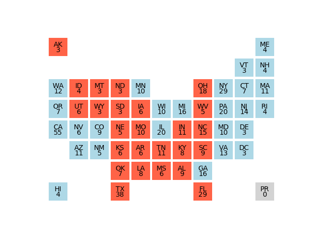
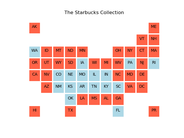
usa_box_plot, a Python code which creates simplified maps of the USA in which each state appears as a box, and the placement of the boxes only roughly corresponds to the relative locations of states on an accurate map.
The information on this web page is distributed under the MIT license.
usa_box_plot is available in a MATLAB version and an Octave version and a Python version.
usa_matrix, a Python code which defines the adjacency matrix for US states, using a variety of matrix formats.